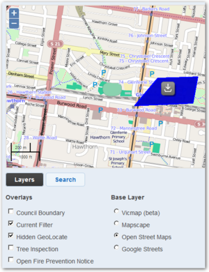
 Maps form a key part of the common operating picture during an event. Crisisworks mapping enables users to interact with the maps without the need to learn to use complex Geographical Information Systems (GIS) software. A GIS can still be used in conjunction with the system for more detailed information if such technical resources are available.
...
Adding external layers to Crisisworks
As an alternative to importing data into Crisisworks, external layers can be configured for live external overlays onto Crisisworks maps.
KML file format
Keyhole Markup Language (KML) is an interoperable international standard notation for Internet mapping which is based on XML and is compatible with Google maps used in Crisisworks. Use this format for adding layers representing information that change infrequently (ie. Municipal boundaries, 1-in-100 year flood extent etc).
The latest versions of MapInfo and ArcGIS are capable of exporting to this format. Shapefiles can be converted using tools such as shape2ge. Google Earth Pro can also be used for editing and managing KML files. Note: Datalink cannot support you in the use of these third party tools are not supported.
- Crisisworks accepts only valid KML files with a .kml extension and does not accept KMZ (.kmz) archives or any other variant of KML.
...
- It can only process the one KML file and although it is possible to upload an archive, the map layer will not display.
- To use information bubbles on the map, add data into the
nameanddescriptionattributes of the feature. It is common for geospatial tools to support writing an HTML table into thedescriptionattribute.
GeoRSS feed
GeoRSS is an emerging standard for encoding locations into web feeds and is also in XML, however can be accessed via a simple URL. The advantage of GeoRSS is that it can be read and updated in near real-time and can be provided by third parties. Use this format for adding layers representing information that changes (ie. Weather data, current fire boundaries etc).
The RSS parser complies with the RSS 2.0 standard. It is important that your feed validates to this standard in order to function properly as a map layer.
...